TROSA Phase II: River, Rights and Resilience
Funding Agency: International Union for Conservation of Nature (IUCN), India
Duration: February 2024- March 2026
Principal Investigator: Dr. Vishal Singh
Field Site: Upper Mahakali region, Uttarakhand
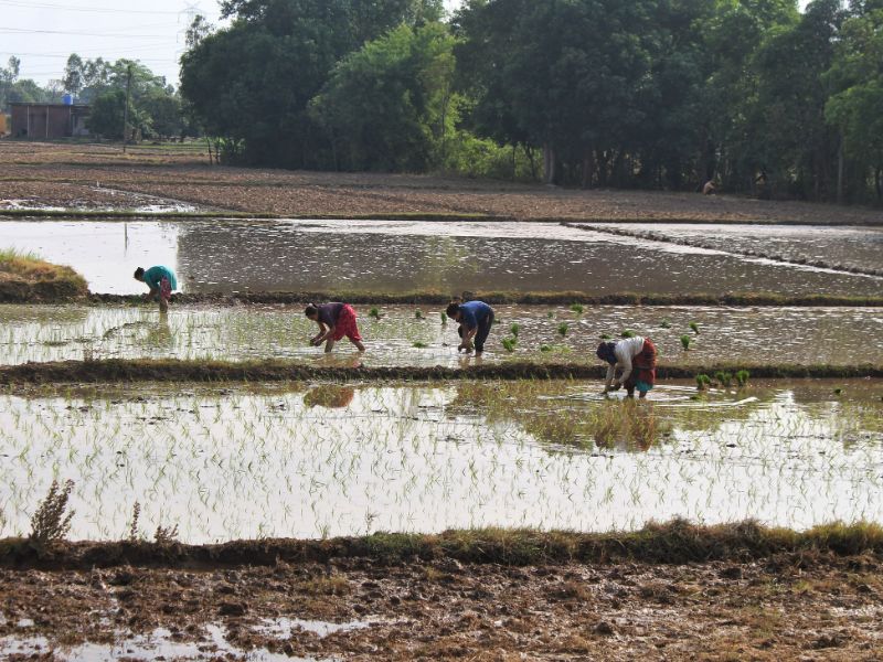
The Mahakali River, which delineates the western border between Nepal and India, holds considerable socio-economic, political, and environmental significance. Historically, it has served as a crucial resource for communities dwelling along its banks, supporting activities such as irrigation, fishing, and domestic usage, thereby contributing significantly to local livelihoods. The socio-economic framework of the Mahakali River basin is predominantly agrarian, with the majority of the population reliant on agriculture and livestock rearing. However, the region grapples with several challenges, including water scarcity attributed to climate change, as well as conflicts concerning water distribution and the development of hydropower projects.
Additionally, limited decision-making roles for women and marginalized individuals, along with water management challenges between Nepal and India in the shared river basin, further complicate water resource management in the region.
TROSA Phase-2: Rivers, Rights and Resilience (T2:3R), works to support climate-resilient livelihoods for vulnerable communities in the Ganges, Brahmaputra and Meghna (GBM) basins. In India, the TROSA project is being carried out in the Mahakali river basin covering two districts of Uttarakhand (Pithoragarh and Champawat) led by CEDAR and two districts of Uttar Pradesh (Pilibhit and Lakhimpur Kheri) led by GDS (Grameen Development Services). The main goal of the project is “Improved cooperation in governing shared water resources, strengthening resilience to climate change of riparian communities in the shared river basin of the Ganges-Brahmaputra-Meghna River systems” with the following outcomes:
(1) Strengthening climate resilient livelihoods of communities living in the Mahakali basin;
(2) improved and inclusive management of shared river basin ecosystems and biodiversity protection;
(3) strengthened leadership of civil society, especially women, indigenous people, and youth, to influence government and private sector on water governance across the basin and;
(4) strengthen cooperation, collaboration, and accountability across and between the shared river basin.
Stakeholder Consultations for Integrated Management Planning of Renuka and Pong Ramsar Sites in Himachal Pradesh (In Collaboration with People’s Science Institute (PSI))
Funding Agency: Deutsche Gesellschaft für Internationale Zusammenarbeit (GIZ)
Duration: 6 months
Project Lead: Dr. Anvita Pandey
Field Site:Himachal Pradesh
Wetlands are one of the most embedded and interlinked ecosystems with human livelihoods and well-being. A balanced management approach addressing biodiversity conservation values while providing for sustainable utilisation in a way compatible with maintenance of natural properties of the ecosystem needs to be adopted for these ecosystems. This forms the core philosophy of ‘wise use’, which is “maintenance of ecological character within the context of sustainable development and achieved through the implementation of ecosystem approaches.” This approach builds on the critical linkages that exist between people and sustainable development of aquatic ecosystems; and encourages community engagement and transparency in negotiating trade-offs and determining equitable outcomes for conservation. The goal of the project is to strengthen the institutional framework and capacities for ecosystem-based integrated management of Renuka and Pong Ramsar sites. It aims to conduct stakeholders’ consultations to support integrated management planning for the above-mentioned Ramsar sites and facilitate intensive stakeholders’ dialogues to discuss various aspects of wetland management. The project plans to generate a common and shared vision to manage the concerned wetlands sustainably.
Hydro-Geological Assessment and Socio-Economic Implications of Depleting Water Resources in Nainital
Funding Agency: Ministry of Water Resources (MoWR)
Duration: 3 Years
Project Lead: Dr. Vishal Singh
Field Site: Nainital City, Uttarakhand
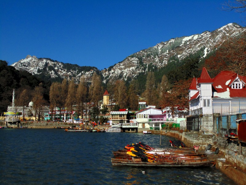
Urban agglomerations across the Indian Himalaya are undergoing rapid expansion and economic transformation. Ever-growing water shortages are a direct and dangerous consequence of such unplanned expansion. The increasing population of such semi-urban sprawls is fuelled by migration from rural areas for jobs, while at the other end of the social spectrum, as the economic status of people improves, their lifestyles result in increasing levels of consumption, one visual icon of which is the supermarket replacing the village shop. Increase in population due to migration; consumptive lifestyles as the economic status of people change; and effects of climate change, are all contributing to ever-growing water shortages. This has led to a situation of water insecurity in the region. When it comes to water, the majority of towns and cities in the Indian Himalayan Region (IHR) are functioning beyond their carrying capacity.
The goal of this project is to assess the critical state of water resources, and to study water supply systems and demand regimes, in a scenario of rapid urbanization aggravated by tourism leading to increasing water insecurity in Nainital. Nainital is situated in the mid altitudinal zone and has a population below 50,000 individuals with high tourist influx. The town is dependent on a lake. Nainital has a central lake traditionally recharged by springs.
Under this project, we are analysing the water supply scenario for Nainital in the state of Uttarakhand and will examine the drivers for the altered regimes of water supply in the lake town Nainital. The possibility of using the ‘carrying capacity’ of the towns to set the limits for growth will also be analysed. We focus on the town with an emphasis on drivers and urbanization trends, the history and present trends of water demand and supply, and the issues related to the sustainability of the critical water zones. There is direct linkage with the Government of India program ‘National Water Mission’, which promotes ensuring integrated water resource management according to Water Mission Goal 2 (Citizen and State Action), Strategy 5 (Encourage participation of NGOs in various activities related to water resource management, particularly in planning, capacity building and mass awareness), Government of India. More efforts would be made to encourage nature-based solutions and facilitate action towards groundwater recharge and rainwater harvesting.
Water Resources Study of Gurgaon
Funding Agency: Interglobe Foundation
Duration: 1 Year
Project Lead: Mr. Chetan Agarwal
Field Site: Gurgaon, Haryana
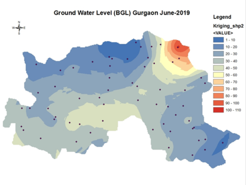
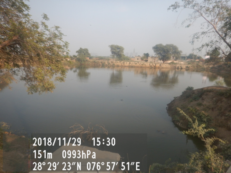
Gurgaon is the fastest growing city in the western Indian state, Haryana, which is a low rainfall arid zone that faces a question mark on the sustainability of its water supply. The population of the state is abstracting groundwater by about 300% and is also dependent on canal flows from the river Yamuna, which faces climatic threats and competing demands. In the study, CEDAR is collaborating with the Gurgaon Metropolitan Development Authority to prepare a report on the current and long-term (till the year 2021) environmental scenario of Gurgaon vis-à-vis its water resources. The project will assess the extent to which the water resources are managed as a common resource pool, the role of communities in their management and options to enhance water security and sustainability. The study will review the water bodies of Gurgaon, the groundwater situation, and the water catchments and nullahs – the green infrastructure of the city.
Establishing a Low-Cost Sensors Network For Air Quality Monitoring in Gurgaon, India
Funding Agency: Clean Air Fund
Duration: 2.5 Year
Project Lead: Mr. Chetan Agarwal
Field Site: Gurgaon, Haryana, India
Gurgaon city has poor air quality, along with Delhi and other cities in the Indo-Gangetic plains. This project aims to support the expansion of Gurgaon’s low-cost sensor air quality network, to complement the regulatory air quality monitoring stations of the state, and generate more reliable air quality data within Gurgaon; improve the understanding of air pollution hotspots in Gurgaon, both geographically and temporally, and make available air quality information for evidence-based policy decisions that catalyse interventions to reduce air pollution.
The project will contribute to the understanding of functioning of low-cost sensor in Indian conditions. It will involve scoping the most effective low-cost sensors with lower margins of error, expanding the low-cost sensor network in Gurgaon according to specified criteria, and facilitating the installing and calibration of the sensors. It will culminate in a publicly accessible database of air quality of the local authorities.